


Where Is Mount Kenya? Location, Map, Distances and How to Get There
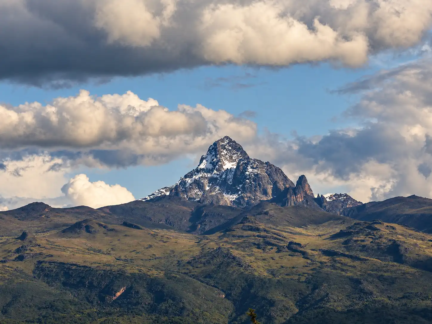
Mount Kenya is in central Kenya, about 150 kilometres north-north-east of Nairobi. It stands just south of the Equator, close to the town of Nanyuki. At 5,199 metres, it is the highest mountain in Kenya and the second-highest in Africa.
The mountain gave the country its name. It is a UNESCO World Heritage Site and the heart of Mount Kenya National Park.
Last updated October 2026. Distances and travel times are approximate.
This guide shows exactly where Mount Kenya is, which towns and counties surround it, how far it is from Nairobi and how to get there.
Where is Mount Kenya? Key facts
Question | Answer |
|---|---|
Country | Kenya, East Africa |
Region | Central Kenya, near the Laikipia Plateau |
Coordinates | About 0°9′ S, 37°18′ E |
Distance from Nairobi | About 150 km in a straight line north-north-east |
Distance from the Equator | About 16 to 20 km south of it |
Nearest big town | Nanyuki, at the northern foot |
Highest peak | Batian, 5,199 metres |
Other peaks | Nelion (5,188 m) and Point Lenana (4,985 m) |
Counties around the mountain | Meru, Embu, Kirinyaga, Nyeri and Tharaka Nithi |
Protected status | National park (1949) and UNESCO World Heritage Site (1997) |
Rank in Africa | Second-highest mountain, after Kilimanjaro |
Mount Kenya on the map
Mount Kenya rises from the central highlands, east of the Great Rift Valley. It is a single, huge mountain that you can see from far away on clear days. The Aberdare Range lies to the west, across a wide valley. The dry plains of Laikipia and the far north lie beyond the mountain's north-west slopes.
The mountain sits where five counties meet: Meru, Embu, Kirinyaga, Nyeri and Tharaka Nithi. Each side has its own towns, gates and trails.
Side of the mountain | Nearest towns | Notes |
|---|---|---|
North and north-west | Nanyuki, Timau | Sirimon gate and Laikipia conservancies |
West | Naro Moru, Nyeri | Naro Moru gate and the shortest, steepest route |
East | Chogoria, Meru | Chogoria gate and scenic gorges |
South | Embu, Kirinyaga | Farmland, tea and coffee country |
Because the mountain lies so close to the Equator, you can cross the Equator line near Nanyuki on the way there.
How far is Mount Kenya from Nairobi and other towns?
From | To Mount Kenya area | Approx. road distance | Approx. drive time |
|---|---|---|---|
Nairobi | Nanyuki (Sirimon side) | 200 km | 3.5 to 4.5 hours |
Nairobi | Naro Moru | 180 km | 3 to 4 hours |
Nairobi | Chogoria | 190 to 200 km | 4 to 5 hours |
Nairobi | Embu | 130 km | 2.5 to 3 hours |
Nanyuki | Sirimon gate | 15 to 20 km | 30 to 45 minutes |
Nanyuki | Naro Moru | 30 km | 40 minutes |
Meru | Chogoria | 70 km | 1.5 hours |
These are rough figures. Traffic, roadworks and weather can change journey times.
The straight-line distance from Nairobi is about 150 km. By road it is longer, because routes curve around the highlands.
How to get to Mount Kenya
There are three main ways to reach the mountain.
Option | How it works | Best for |
|---|---|---|
Private or operator transfer | A vehicle collects you in Nairobi and drives to the gate | Most trekkers and groups |
Shared matatu or bus | Public transport from Nairobi to Nanyuki, Naro Moru or Chogoria, then a transfer to the gate | Budget travellers |
Flight to Nanyuki | A short flight from Nairobi, then a road transfer | Travellers short on time |
By road
The road from Nairobi runs north through Thika, Karatina and Naro Moru to Nanyuki. It is paved and busy in places. Allow a full half-day for the trip, with breaks.
By air
Nanyuki has an airstrip with scheduled and charter flights from Nairobi. This saves several hours on the road and pairs well with a Laikipia safari.
Gates
The main gates are Sirimon on the north-west side, Naro Moru on the west and Chogoria on the east. Your operator will plan your start point and your exit.
Plan to arrive the evening before your trek. A night near the gate helps you rest and start early.
About Mount Kenya
Mount Kenya is an extinct volcano. Its last eruption was millions of years ago. Ice and weather have since carved its jagged peaks, deep valleys and glacial lakes.
The highest summit, Batian, was first climbed in 1899. Its neighbour Nelion is almost as high. Point Lenana, the third peak, is the one most trekkers reach. It is a walk, not a technical climb.
A few small glaciers remain on the upper slopes, and they are shrinking fast. Below them, the mountain changes from farmland to forest, bamboo, moorland and strange alpine plants such as giant groundsels and lobelias.
The mountain is sacred to many communities. In Kikuyu it is Kirinyaga, and other peoples around it have their own names. The name Kenya is believed to come from the mountain.
Mount Kenya National Park was set up in 1949. The park and the forest around it were listed as a UNESCO World Heritage Site in 1997.
Where to stay near Mount Kenya
Your base depends on your gate and your plans.
Base | Best for | What you will find |
|---|---|---|
Nanyuki | Sirimon climbs, Laikipia safaris, shopping and flights | The widest choice of hotels, lodges and guesthouses |
Naro Moru | The Naro Moru route and budget stays | Simple lodges and hostels close to the gate |
Chogoria | The Chogoria route and the eastern side | Small lodges and mountain camps |
Timau | A quiet start on the north-east side | Farm stays and country lodges |
Inside the park | Staying close to the peaks | Mountain huts and public campsites |
Spend a night or two near the mountain before you climb. It gives your body time to adjust to the altitude. Nanyuki sits at about 1,900 metres, so it is a good first step.
Whatever you choose, book early for the dry months, from January to February and July to September.
Climbing routes by location
Each route starts from a different side of the mountain.
Route | Side | Character |
|---|---|---|
North-west, near Nanyuki | Gentle and gradual. Popular for ascent | |
West | Shortest and steepest. Often used for descent | |
East | Very scenic, with gorges and lakes | |
Burguret | North-west | Quiet and less used. Needs special arrangements |
Timau | North | Rarely used. Needs special arrangements |
Sirimon, Naro Moru and Chogoria have staffed park gates. Less-used routes need extra permission from the Kenya Wildlife Service.
Many climbers go up one side and down another. A common choice is Sirimon up and Chogoria or Naro Moru down. For prices, see our guide to Mount Kenya climbing cost.
Best time to visit Mount Kenya
The mountain has two dry seasons that suit most visitors.
Months | Conditions | Good for |
|---|---|---|
January to February | Dry, clear and warm days | Trekking and views |
July to September | Dry and cold at altitude | Trekking and safaris |
March | Warming up, rain may start | Quieter trails |
April to May | Long rains, wet and slippery | Fewer visitors, lower prices |
October to December | Short rains | Fresh green scenery |
Weather changes with altitude. It can be warm in Nanyuki and freezing at the summit. Temperatures fall about 6°C for every 1,000 metres you climb. Mornings are usually clearest, so the peaks are often hidden by cloud later in the day.
Things to do around Mount Kenya
You do not have to climb to enjoy the mountain.
Activity | Where | Why go |
|---|---|---|
Trek to Point Lenana | Sirimon, Naro Moru or Chogoria | The classic climb to 4,985 metres |
Day walk in the lower forest | Park gates | Birds, monkeys and mountain views |
Laikipia conservancies | Ride past zebra, giraffe and rhino | |
Game drives and walking safaris | Laikipia | Wildlife with Mount Kenya as a backdrop |
Equator crossing | Near Nanyuki | A classic photo stop |
Trout fishing and waterfalls | Mountain streams | A gentle, scenic day out |
Farm and tea visits | Meru and Embu side | Local food, culture and landscapes |
Many visitors combine a Mount Kenya trek with a Laikipia safari or a few days in the Masai Mara.
Frequently asked questions
Where is Mount Kenya located?
Mount Kenya is in central Kenya, about 150 kilometres north-north-east of Nairobi and just south of the Equator. Nanyuki lies at its northern foot.
Which county is Mount Kenya in?
It sits where five counties meet: Meru, Embu, Kirinyaga, Nyeri and Tharaka Nithi. Nanyuki, on the north side, is in Laikipia County.
How far is Mount Kenya from Nairobi?
About 150 km in a straight line. By road, the nearest gates are roughly 180 to 200 km away, about 3 to 5 hours' drive.
How high is Mount Kenya?
Batian, the highest peak, is 5,199 metres. Point Lenana, the trekking peak, is 4,985 metres.
Is Mount Kenya higher than Kilimanjaro?
No. Kilimanjaro in Tanzania is higher. Mount Kenya is the second-highest mountain in Africa.
Is Mount Kenya on the Equator?
It is very close. The mountain stands about 16 to 20 km south of the Equator.
What is the nearest town to Mount Kenya?
Nanyuki is the best-known base on the northern side. Naro Moru is on the west and Chogoria on the east.
Is Mount Kenya a volcano?
Yes, but it is extinct. Its last eruption was millions of years ago.
Is Mount Kenya a UNESCO World Heritage Site?
Yes. The national park and forest were listed in 1997.
Can you see Mount Kenya from Nairobi?
On exceptionally clear days it can be seen from some high places, but it is usually hidden. Views are much better from Nanyuki and the Laikipia plains.
How do I get to Mount Kenya?
By road from Nairobi to Nanyuki, Naro Moru or Chogoria, or by a short flight to Nanyuki followed by a road transfer. Most trekkers use an operator transfer.
When is the best time to visit Mount Kenya?
January to February and July to September are the driest and best for trekking and views.
Plan your Mount Kenya trip with Olengugih Safaris
Olengugih Safaris is a Kenya-based safari operator. We can plan your Mount Kenya trek, arrange transfers from Nairobi and add a Laikipia horse riding safari, a game drive or a few days in the Masai Mara.
Contact Olengugih Safaris to plan your Mount Kenya adventure.
Sources and further reading
- Mount Kenya, Wikipedia
- Mount Kenya, Encyclopaedia Britannica
- UNESCO World Heritage Centre, Mount Kenya National Park/Natural Forest
- Kenya Wildlife Service, Mount Kenya National Park