About This Climbing Route
Naro Moru Route on Mount Kenya
Naro Moru approaches Mount Kenya from the western side and is known for being comparatively direct. Its shorter line toward the higher mountain can be attractive to time-conscious trekkers, but the steep ascent offers less margin for acclimatization if rushed. The route is especially associated with the Met Station, the wet Vertical Bog and the Mackinder's Camp area below the summit massif.
Gate, forest and Met Station
Trekkers approach the national park through Naro Moru and begin climbing from the park gate. The route moves through forest and reaches the Met Station area, often used as an early overnight or rest point. Weather can shift quickly as the trail rises; lower slopes that look straightforward may become slippery after rain.
The Vertical Bog and Teleki Valley
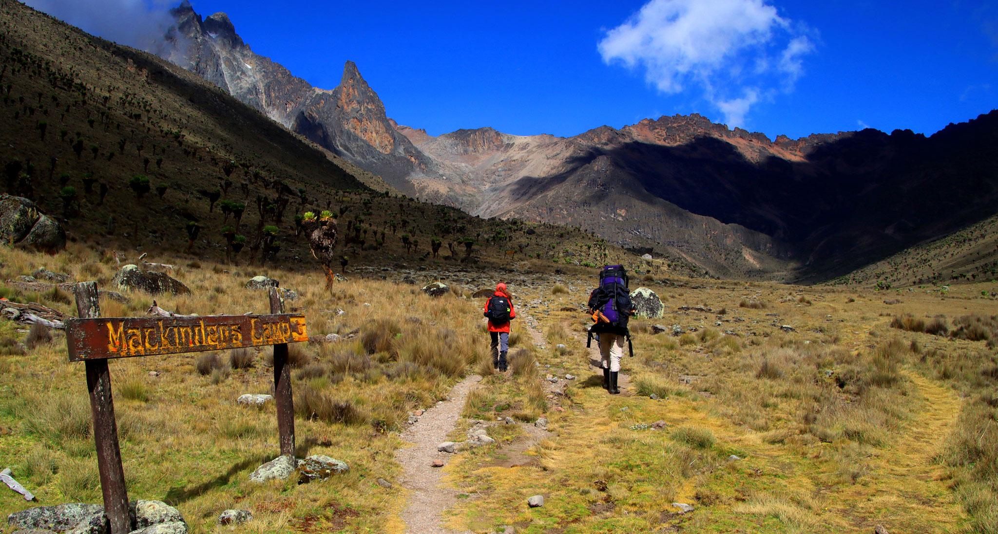
Higher up, walkers encounter the notorious Vertical Bog, a wet and uneven section through tussock grass and saturated ground. It can be tiring and slow in poor conditions. Beyond this section the vegetation thins and the upper landscape begins to open toward Teleki Valley, with Mackinder's Camp a familiar staging point for longer programmes.
Point Lenana summit and alternate descents
Summit attempts typically continue toward the upper ridge system and Point Lenana, sometimes via the Austrian Hut region depending on the chosen line. The final ascent is a high-altitude undertaking that can involve pre-dawn walking, frost and exposed rock. Travellers may return on Naro Moru or finish a traverse through another park gate, but both the route and transport must be confirmed in writing.
Who Should Choose This Route?
Naro Moru offers an efficient western approach and a clear contrast with the expansive moorland of Sirimon or the lake scenery of Chogoria. It is not necessarily the easiest option. Strong trekking fitness helps, and hikers who need more time to acclimatize should consider adding a day or choosing a gentler ascent.
Preparation, Altitude and Safety
Muddy ground can be slippery on both the ascent and the descent; use reliable footwear and consider trekking poles where the guide recommends them. Higher camps are cold, and an overly rapid climb increases altitude illness concerns. Confirm ranger requirements, camp facilities, water, rescue plans and how long the summit and descent day may take.
When to Go and What to Confirm
Mount Kenya weather remains changeable year-round. Rain often makes the bog considerably harder, but even drier months can bring mountain mist and frost. A route comparison should consider actual walking days, transfer times and overnight elevations rather than claiming every Naro Moru itinerary can be done safely in three days.
Frequently Asked Questions
What is the Vertical Bog?
A steep, often waterlogged area of the Naro Moru trail with slippery grass and uneven footing.
Is Naro Moru the easiest Mount Kenya trail?
Not necessarily. Its direct approach can mean steeper walking and less gradual altitude gain.
Can it be used only for descent?
Yes. Some Mount Kenya traverses ascend another route and finish via Naro Moru, subject to verified logistics.
This route guide is general planning information. Refer to the linked expedition packages for the actual day-by-day schedule. Exact camp arrangements, park requirements, fees, equipment and services must be confirmed in an Olengugih Safaris quotation before travel.