Discover Mount Ololokwe
Mount Ololokwe: The Tabletop Mountain of Samburu
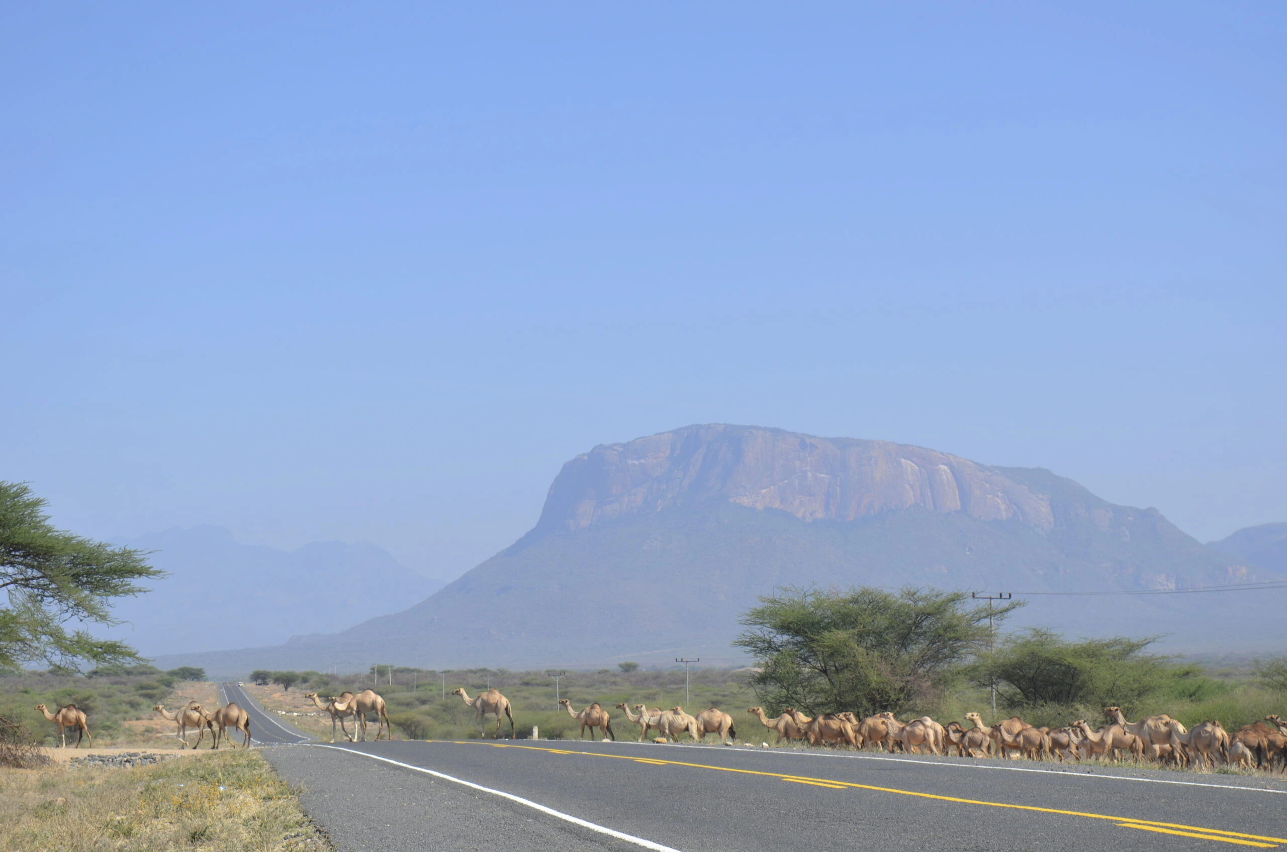
Mount Ololokwe, also known as Ol Donyo Sabache, rises dramatically above the open landscapes of Samburu County in northern Kenya. Unlike the long high-altitude approaches of Mount Kenya or Kilimanjaro, Ololokwe is admired for its almost sheer rock faces, broad summit plateau, changing vegetation and far-reaching views. It is a rewarding hiking destination for active travellers who value landscape, local culture, photography and an adventurous ascent rather than a technical summit expedition.
The mountain lies north of Archer’s Post, close to the Nairobi–Moyale road corridor. Its upper plateau is generally described at around 1,970 to 2,000 metres above sea level, although map sources report slightly different measurements. The mountain stands much higher than the nearby plains, making its silhouette visible from a long distance. Ololokwe is not a 5,000 metre altitude climb; its challenge comes from steep terrain, warm conditions on the approach, exposed sections and the effort of gaining height within a relatively short distance.
Location and How to Reach Mount Ololokwe
Ololokwe is in Samburu County, north of the central Kenya highlands and beyond Isiolo and Archer’s Post. Many itineraries travel north from Nairobi via Nanyuki and Isiolo, although exact travel time depends on the departure location, road conditions and the access point chosen. The route changes visually from settled agricultural and highland landscapes to the striking dry country of northern Kenya. The final approach to the hiking trailhead may require appropriate transport for unpaved access roads.
A commonly described starting point is the Sabache Camp area at the foot of the mountain. Visitors should arrange their actual meeting point, local guide, entry conditions and any community or conservation permissions before travelling. The name Ololokwe may also be written Ol Donyo Sabache, and visitors may encounter spelling variations on local signage or trekking information.
What Makes the Ololokwe Landscape Special?
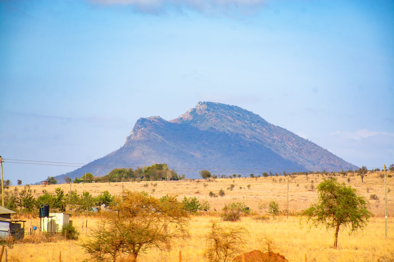
Ololokwe has a distinctive flat-topped profile framed by imposing cliffs. At the base, the environment is often dry, hot and dotted with thorny shrubs or acacia woodland. Higher on the mountain, the walking route enters greener areas and locally forested terrain. The contrast between the open Samburu plains and the upper vegetation is one of the most memorable qualities of the hike.
From suitable summit viewpoints, clear conditions may reveal broad swathes of Samburu country, the Mathews Range and distant ridges. Sunset and sunrise can be particularly atmospheric for groups staying overnight. These panoramas depend on visibility, and the safest viewpoints should be chosen with the local guide because some cliff edges and rocky drop-offs are exposed.
Cultural Significance to Samburu Communities
Ololokwe is more than an impressive landscape. It holds deep cultural and spiritual importance for Samburu communities. Accounts of the mountain describe traditional prayer and ceremonial associations, and the surrounding area continues to be closely connected to local pastoral life. Visitors should approach the mountain with respect for community values, local customs and access guidance.
A responsible hike includes engaging appropriately with local guides and service providers, asking before photographing people, staying within approved walking and camping areas, and following instructions about culturally sensitive places. Travellers should not treat sacred areas as unrestricted attractions or assume that every activity is permitted without local agreement.
The Mount Ololokwe Summit Trail
From the Trailhead to the Rocky Slopes
The hike usually begins near the lower mountain with a briefing, equipment check and confirmation of drinking water. The ascent is often steep, with sections of loose stones, rocky steps, narrow walking lines and warm, exposed ground. Some descriptions refer to tracks historically used by elephants. This does not make wildlife encounters predictable or safe: hikers should remain with the guide and follow instructions about animals and trail conditions.
Climbing Toward the Summit Plateau
As height increases, the landscape opens to sweeping views over the plains. Depending on the particular line taken, walkers may pass through patches of thicker vegetation before reaching the broad upper mountain. The climb requires a steady pace, short rests and careful foot placement. Some sections may be slippery in rain or difficult for hikers who are uncomfortable with steep ground.
The Summit Experience and Descent
The upper plateau provides the main scenic reward. Hikers can pause at guide-approved viewpoints for photographs and look over the dramatic relief between the summit and the surrounding country. Descent often tests the knees and footing more than expected, so a successful morning ascent does not remove the need to preserve energy and water for the return.
Day Hike or Overnight Summit Camping?
One Day Ololokwe Hike
A day hike focuses on the climb, summit scenery and descent without an overnight camp on the mountain. Various hiking references give roughly five to eight hours for a complete round trip, but this is only an approximate planning range. Fitness, heat, weather, stops, trail conditions and the exact route can all change the walking time. Travellers starting in Nairobi should also account for a substantial road journey rather than assuming that driving and hiking fit comfortably into the same short day.
Two Day Hike with Summit Camping
A two day experience typically involves ascending on the first day, camping on or near an approved upper area, watching sunset if weather permits, and descending after sunrise the following morning. Camping services may be basic; tents, sleeping mats, warm clothing, cooking arrangements, toilets, porters, water supply and permissions must be confirmed with the operator and local hosts. The summit may be cool or windy at night despite warm conditions at the trailhead.
Three Day Mount Ololokwe and Samburu Safari
The existing Olengugih climbing catalogue also includes a three day adventure combining Mount Ololokwe hiking with Samburu wildlife viewing. It introduces a different dimension to the trip, contrasting the mountain plateau with the dry-country wildlife habitats of Samburu. The detailed schedule, park entry, accommodation, game drives and transport must be confirmed before booking because the published package is a research-based itinerary, not a guarantee of every service.
View the three day Mount Ololokwe and Samburu adventure or explore the Ololokwe Summit Trail for the relevant route information.
Difficulty, Fitness and Who Should Hike Ololokwe
Ololokwe is generally considered a moderate to challenging hike depending on the chosen trail, pace and weather. The standard hiking route is not normally marketed as a technical rock climb, but steep ground, uneven footing and potentially exposed sections make preparation important. Hikers should be comfortable with continuous uphill walking followed by a careful, sometimes tiring descent. Anyone with significant mobility, balance or heat-tolerance concerns should discuss the route and alternatives before confirming a climb.
A sensible preparation plan includes regular walks, hill training, stair climbing and using the footwear intended for the mountain. Shorter practice hikes help a person evaluate their endurance and how they manage walking in heat. This mountain is lower than Kilimanjaro and Point Lenana, but dehydration, slips, sun exposure and sudden weather changes remain real risks.
Weather and the Best Time to Visit
Northern Kenya can be hot and dry, especially on exposed lower sections of the trail. Generally drier periods are often more convenient for hiking, but weather patterns vary and rain can make the steep terrain slippery. Early starts may reduce exposure to the strongest heat, subject to local guidance. The mountain should never be treated as reliably dry or safe simply because of the month on the calendar.
Travellers planning to camp should carry suitable warm layers even when the departure town feels hot. Confirm the current forecast, visibility, local trail condition and access rules close to departure. A local guide may advise postponement or a different walking plan when conditions are unsuitable.
Equipment and Practical Preparation
- Wear well-fitted hiking boots or shoes with dependable grip for steep rock and loose ground.
- Carry sufficient drinking water for the planned route and heat; confirm whether refill points are usable before relying on them.
- Pack a breathable hiking layer, sun hat, sunscreen, sunglasses and a light waterproof shell.
- Bring snacks, a basic personal first-aid kit, any required medication and a fully charged phone or suitable communication arrangement.
- For an overnight climb, confirm tents, warm sleeping systems, food, cooking support, porters and sanitation arrangements in advance.
- Follow local advice for wildlife, steep edges, navigation, camping permissions and protection of culturally important places.
- Avoid littering, unnecessary noise, collecting plants or rocks, and walking outside agreed routes.
Responsible Hiking and Mountain Conservation
The surrounding Samburu landscape supports local communities, wildlife habitats and sensitive vegetation. Responsible trekking protects these values by using authorised paths, keeping camps clean and limiting disturbance. Visitors should arrange qualified local support where required, communicate respectfully, and avoid leaving waste on the mountain. Never approach wildlife for a closer picture or assume that a seasonal spring provides safe drinking water.
Mount Ololokwe Frequently Asked Questions
Where is Mount Ololokwe located?
Mount Ololokwe is in Samburu County in northern Kenya, near the Archer’s Post region along the wider Nairobi–Moyale road corridor.
How high is Mount Ololokwe?
Its upper mountain is commonly described at about 1,970 to 2,000 metres above sea level. Mapping sources vary slightly, so treat this as an approximate height rather than a guaranteed exact summit figure.
How long does it take to hike Mount Ololokwe?
A complete day hike often takes around five to eight hours of walking, but the actual time depends on the trailhead, group fitness, weather and stops. A two day itinerary allows a more relaxed overnight summit-camping experience.
Is the Ololokwe summit hike suitable for beginners?
Active beginners with preparation may enjoy a guided hike, but the steep terrain and heat can make it demanding. A local guide should assess the planned route and the group’s experience.
Can visitors camp on Mount Ololokwe?
Overnight camping is offered on some guided itineraries. Permission, approved locations, support equipment and available facilities should be confirmed before departure.
Does the climb require technical mountaineering equipment?
The usual guided walking route is distinct from technical cliff climbing. Proper hiking footwear and appropriate safety arrangements are still essential; any specialist climbing activity requires separate assessment.
Can a Mount Ololokwe hike be combined with a safari?
Yes. The existing three day itinerary pairs the mountain hike with Samburu wildlife experiences, subject to confirmed transport, fees and accommodations.
Explore More Ololokwe Information
For background on the mountain’s landscape and cultural importance, see the AbiriKenya Mount Ololokwe overview. Local hiking operators also publish practical summaries of summit walking and camping arrangements. Fees, permissions and trail access should always be checked again near your intended travel dates.